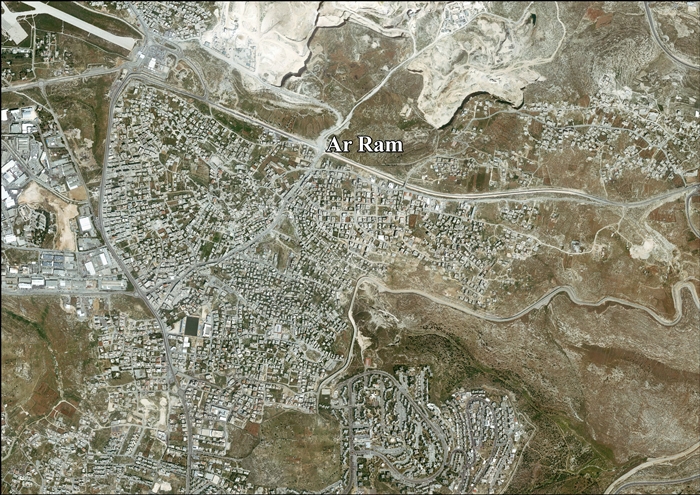
A-Ram ' atau al-Ramm ' (bahasa Arab : الرّام ;) adalah kota Palestina yang terletak di timur laut Yerusalem , tepat di luar perbatasan kota. Desa ini adalah bagian dari kawasan perkotaan Yerusalem , dan zona industri Atarot dan Beit Hanina terletak di Barat, dan Neve Yakub berbatasan di Selatan.[ 1] dunums . Menurut Biro Pusat Statistik Palestina , a-Ram memiliki populasi 25,595 pada tahun 2006.[ 2] Israel .[ 3]
Ar-Ram
• Arab الرّام • Ejaan lain al-Ramm (resmi) Ar-Ram
Kegubernuran Yerusalem • Jenis Munisipalitas • Yurisdiksi 3,289 dunams (33 km2 or 13 sq mi) • Yurisdiksi 25.595 Arti nama "The Hill"/"Stagnant water"[ 4]
Sejarah
Dalam Crusader , Al-Ram bernama Aram, Haram, Rama, Ramatha, Ramitta, atau Ramathes .[ 5]
Al-Ram adalah salah satu dari 21 desa yang diberikan oleh raja Godfrey sebagai perdikan untuk Gereja Makam Suci [ 6] [ 7]
Semua penduduk desa yang disebutkan dalam sumber-sumber Tentara Salib antara 1152 dan 1160 memiliki nama yang berarti mereka adalah Kristen.[ 8] [ 9]
Kota Saudara
Referensi
^ "The Separation Barrier surrounding a-Ram" . Btselem. January 1, 2014. Diakses tanggal 18 January 2014 .^ "Projected Mid -Year Population for Jerusalem Governorate by Locality 2004- 2006" . Palestinian Central Bureau of Statistics asli tanggal February 7, 2012. Diakses tanggal January 9, 2015 .^ "Israel's Apartheid Wall Surrounding a-Ram" . B'Tselem asli tanggal September 27, 2011. Diakses tanggal January 9, 2015 .^ Palmer, 1881, p. 324
^ Pringle, 1998, p. 179
^ Conder dan Kitchener, 1883, SWP III, p. 11
^ de Roziére, 1849, ms. 263 : Haram , dikutip dalam Röhricht, 1893, RRH, p. 16 -17, No 74
^ Röhricht, 1893, RRH, ms. 70 - 71 , No 278; 92 , ms. No 353
^ Pringle, 1998, mukasurat 180
Bibliografi
Wikimedia Commons memiliki media mengenai
Al-Ram .
Barron, J. B., ed. (1923). Palestine: Report and General Abstracts of the Census of 1922 (PDF) . Government of Palestine. Conder, C. R. (1881). "Lieutenant Conder´s reports" . Quarterly statement - Palestine Exploration Fund . 13 : 158– 208.Conder, Claude Reignier ; Kitchener, H. H. (1883). The Survey of Western Palestine: Memoirs of the Topography, Orography, Hydrography, and Archaeology Committee of the Palestine Exploration Fund .Guérin, Victor (1874). Description Géographique Historique et Archéologique de la Palestine Pemeliharaan CS1: Bahasa yang tidak diketahui (link ) Hadawi, Sami (1970). Village Statistics of 1945: A Classification of Land and Area ownership in Palestine Hütteroth, Wolf-Dieter; Abdulfattah, Kamal (1977). Historical Geography of Palestine, Transjordan and Southern Syria in the Late 16th Century . Erlanger Geographische Arbeiten, Sonderband 5. Erlangen, Germany: Vorstand der Fränkischen Geographischen Gesellschaft. ISBN 3-920405-41-2 Mills, E., ed. (1932). Census of Palestine 1931. Population of Villages, Towns and Administrative Areas (PDF) . Jerusalem: Government of Palestine. Palmer, E. H. (1881). The Survey of Western Palestine: Arabic and English Name Lists Collected During the Survey by Lieutenants Conder and Kitchener, R. E. Transliterated and Explained by E.H. Palmer Committee of the Palestine Exploration Fund .Pringle, D. (1983). "Two Medieval Villages North of Jerusalem: Archaeological Investigations in Al-Jib and Ar-Ram". Levant 15 : 141– 177, pls.xvi-xxiia. Pringle, Denys (1997). Secular buildings in the Crusader Kingdom of Jerusalem: an archaeological Gazetter Cambridge University Press . ISBN 0521 46010 7 Pringle, Denys (1998). The Churches of the Crusader Kingdom of Jerusalem: L-Z (exluding Tyre) Cambridge University Press . ISBN 0 521 39037 0 Robinson, Edward ; Smith, Eli (1841). Biblical Researches in Palestine, Mount Sinai and Arabia Petraea: A Journal of Travels in the year 1838 Crocker & Brewster .108 , 114 , 141 )Röhricht, Reinhold (1893). (RRH) Regesta regni Hierosolymitani (MXCVII-MCCXCI) 491 : Aram (Haram), p. 504 : Rama, Ramatha )Röhricht, Reinhold (1904). (RRH Ad) Regesta regni Hierosolymitani Additamentum 129 : Aram #74; p. 134 : er Ram #74; Rama #30a; (Rame? #512)de Roziére, ed. (1849). Cartulaire de l'église du Saint Sépulchre de Jérusalem: publié d'après les manuscrits du Vatican Pemeliharaan CS1: Bahasa yang tidak diketahui (link ) Toledano, E. (1984). "The Sanjaq of Jerusalem in the Sixteenth Century: Aspects of Topography and Population". Archivum Ottomanicum . 9 : 279– 319. Wilson, Charles Williams, ed. (1881, 1884): Picturesque Palestine, Sinai and Egypt vol 1 of 4.
Pranala luar


