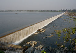
Tributary of river Godavari
The Manjira river is a tributary of the river Godavari . It passes through the states of Maharashtra , Karnataka and Telangana . It originates in the Balaghat range of hills near the Ahmednagar district at an altitude of 823 metres (2,700 ft) and empties into the Godavari River . It has a total catchment area of 30,844 square kilometres (3,084,400 ha).[ 1] Triveni Sangam .
Description
The river's origin is near the Gavalwadi village of the Beed district . The river flows from the northern boundaries of the Osmanabad district , cutting across the Latur district , goes to the Bidar district and finally Telangana . It flows on the Balaghat plateau along with its tributaries: Terna, Tawarja and Gharni. The other three tributaries of Manjara are Manyad, Teru and Lendi which flow on the northern plains.
The final stretch of the river forms the border between Maharashtra (west) and Telangana (east). Manjira, along with the Haridra River , merges with Godavari River at the border.
Tributaries
Terna River : This is the main tributary of Manjara, which flows on the southern boundary of the Ausa Taluka .Manyad: This river has its origin at Dharmapuri, and flows through the Ahmadpur Taluka t .
Lendi: This river has its origin in Udgir Taluka , and flows through the Ahmadpur Taluka, joining the Tiru river in Nanded district .
Gharni: This river has its origin near Wadval and flows through Chakur Taluka .
Tawarja: This river has its origin near Murud in Latur Taluka , and joins the Manjara river at Shivani on the Latur-Ausa boundary.[ 2]
Environment
In the late 20th and early 21st centuries, the upper reaches of the Manjira in Maharashtra suffered environmental degradation , which increased runoff , as opposed to groundwater recharge , and increased erosion and silting .[ 3] [ 4] [ 5]
References
Rivers Waterfalls Lakes Beaches Dams
Rivers Waterfalls Lakes Dams
Rivers
Major tributaries Minor tributaries Sub-tributaries
Dams, barrages Geographical Riparian districts
Cities Languages / people Coalfields Oil / gas fields Industries Transport
Highways and railways Bridges on Godavari
Pollution concerns,
Algal bloom in reservoirsHigh alkalinity of river water in the river basin upstream of Pochampadu dam Frequent floods in tail end area of the river basin
Alkali salts / high pH water run off from ash / red mud dumps of coal fired power stations / bauxite ore enrichment
Excessive silting of reservoirs due to deforestation and mining activities Related topics Other basins
19°55′48″N 73°31′39″E / 19.9300°N 73.5275°E / 19.9300; 73.5275


