According to the 2010 census, Lake County is the second wealthiest county in the state by per capita income, after DuPage County. Additionally, Lake County ranks as the 27th wealthiest county in the nation. The county includes the affluent North Shore communities of Lake Forest, Lake Bluff, and Highland Park, and much of the county's wealth is concentrated in this area, as well as in communities bordering Cook County to the south and McHenry County to the west. The north and northwest areas of the county, though historically rural and exurban, have experienced rapid suburbanization in the past three decades, while the lakefront communities of Waukegan, North Chicago, and Zion are postindustrial areas that have majority-minority populations. The Hispanic population has seen significant increases in nearly all areas of the county and comprise 24% of the county's population in 2020. Naval Station Great Lakes is located in the city of North Chicago. It is the United States Navy's Headquarters Command for training, and the Navy's only recruit training center.
The Caspar Ott Cabin[broken anchor], built in 1837, is the oldest structure in Lake County.Lake County at the time of its creation in 1839
The county was created by the Illinois State Legislature in 1839. At that time, the county was mostly unsettled; Libertyville, then known as Independence Grove, was the first county seat. In 1841, however, the county's residents voted to move the county government to Little Fort, now Waukegan, where the commissioners had purchased a section of land from the state. Lake County's first courthouse was built on part of that land in 1844 and the remainder was sold to pay for the $4,000 construction cost.
The county's first courthouse was used solely for court sessions and the jail, but in 1853, commissioners constructed a building to accommodate county administration offices and house records. When fire damaged the courthouse on October 19, 1875, the county records were saved because they were in the adjacent building.
After the fire, proposals were made to move the county seat to Highland Park, Libertyville or another site in central Lake County. The county commissioners, however, decided to rebuild in Waukegan. The east half of the building was reconstructed at a cost of $45,000. In 1895, the first jail building was added to the government complex and a west addition was added to the courthouse in 1922. By 1938, county commissioners saw a need for additional space and approved the addition of a 5th Floor. This courthouse, however, was demolished in 1967 to make room for a new high-rise administration building, which was completed with the addition of the jail in 1969 and courts in 1970.
Shortly thereafter, the Lake County Board commissioned the construction of a multi-faceted justice facility and ground was broken in 1986 for the Robert H. Babcox Justice Center, named in memory of Sheriff Babcox, who served as Lake County Sheriff from 1982 to 1988. The justice center, which houses the county jail, work release program, sheriff's administration offices and three courtrooms, was finished in 1989 at a cost of $29.6 million.
Additional county government facilities have been built or expanded throughout Lake County, including the Coroner's Office, Health Department/Community Health Center facilities, Division of Transportation, Public Works and Winchester House. Lake County government services extend throughout the county's 470 square miles (1,200 km2).
The historic Half Day Inn, a tavern/restaurant, was constructed in 1843. This structure, once located at the corner of Milwaukee Avenue and Rte. 45/Old Half Day Road, was one of the oldest structures in Lake County until it was demolished in 2007 to make way for retail space, condominiums, and a retention pond.
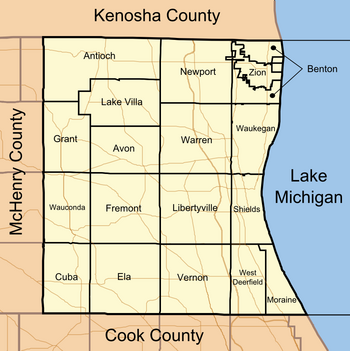
Geography
A satellite view of the Lake County district
According to the U.S. Census Bureau, the county has a total area of 1,368 square miles (3,540 km2), of which 444 square miles (1,150 km2) is land and 935 square miles (2,420 km2) (67.6%) is water.[3] It is the second-largest county in Illinois by total area and the only one that has more water area than land area. Most of the water is in Lake Michigan.
Lake County's forest preserves and natural areas are administered by the Lake County Forest Preserves district. These facilities include traditional nature preserves, such as the Ryerson Conservation Area, as well as golf courses and historic homes, such as the Adlai Stevenson historic home.[4] A long north–south string of the preserves in Lake County, including Half Day Woods, Old School Forest Preserve, Independence Grove, and Van Patten Woods, form the Des Plaines River Greenway, which contains the Des Plaines River Trail, a popular place for walking, running, and biking. Lake County is also home to Illinois Beach State Park, featuring over six miles of Lake Michigan shoreline, as well as dune areas, wetlands, prairie, and black oak savanna. Several local environmental groups operate in Lake County, such as Conserve Lake County and Citizens for Conservation, working to improve habitat. Volunteer opportunities also exist with the Lake County Forest Preserve District.[5]
Lake County's county road system currently covers 300 miles of road.[6] The county also employs two different numbering systems, a county route system and a county highway system. While both systems' can be seen on official road maps, only the County Route designations have been indicated with highway markers on traffic signals or dedicated poles.
The county route system in use today by Lake County was purportedly intended to be the dominant system for all of Illinois' counties and was proposed by the National Association of Counties (NACo), however their system was not chosen and instead each county was given the freedom to number their own county routes as well as choose whether or not to produce and display highway markers. Currently, only Lake County, Boone County, McHenry County and Cook County use NACo's proposed numbering system, and of the four only Lake and McHenry counties chose to fully display the county route designations on highway markers. Cook County began to roll out the production of highway markers near the beginning of 2009, but the seemingly arbitrary numbering system as well as the cost to produce the markers resulted in a lot of confusion and backlash, and ultimately only some of the markers were produced and mounted.[7]
For Lake County, all East–West-bound County Routes begin with an "A", while North—South-bound County Routes on the western half of the county begin with a "V", and those located on the eastern half begin with a "W".[citation needed]
U.S. Decennial Census[9] 1790-1960[10] 1900-1990[11] 1990-2000[12] 2010-2020[1]
2020 census
Lake County, Illinois – Racial and Ethnic Composition Note: the US Census treats Hispanic/Latino as an ethnic category. This table excludes Latinos from the racial categories and assigns them to a separate category. Hispanics/Latinos may be of any race.
As of the 2010 Census, there were 703,462 people, 241,712 households, and 179,428 families residing in the county.[25] The population density was 1,585.6 inhabitants per square mile (612.2/km2). There were 260,310 housing units at an average density of 586.7 per square mile (226.5/km2).[3] The racial makeup of the county was 75.1% white, 7.0% black or African American, 6.3% Asian, 0.5% American Indian, 8.5% from other races, and 2.6% from two or more races. Those of Hispanic or Latino origin made up 19.9% of the population.[25] In terms of ancestry, 20.5% were German, 12.9% were Irish, 9.4% were Polish, 6.9% were Italian, 6.5% were English, and 4.0% were American.[26]
Of the 241,712 households, 40.8% had children under the age of 18 living with them, 59.6% were married couples living together, 10.4% had a female householder with no husband present, 25.8% were non-families, and 21.5% of all households were made up of individuals. The average household size was 2.82 and the average family size was 3.31. The median age was 36.7 years.[25]
The median income for a household in the county was $78,948 and the median income for a family was $91,693. Males had a median income of $62,042 versus $44,200 for females. The per capita income for the county was $38,120. About 4.8% of families and 7.0% of the population were below the poverty line, including 9.6% of those under age 18 and 5.6% of those age 65 or over.[27]
The White population continued to remain the largest racial category and included 17.3% of Hispanics in Lake County who identify as White. A plurality of Hispanics identified as Multiracial (48.5%) with others continuing to identify as Some Other Race (29.1%) and smaller amounts identifying as Black (0.5%), American Indian and Alaskan Native (4.0%), Asian (0.4%), and Hawaiian and Pacific Islander (0.1%).[28] By ethnicity, 23.1% of the total population was Hispanic-Latino (of any race) and 76.9% is Non-Hispanic (of any race). If treated as a separate category, Hispanics are the largest minority group in Lake County, Illinois[28] surpassing the Black population from the 1990 Census onward. The majority of Hispanic/ Latino residents in Lake County, Illinois are of Mexican descent (18.0% of the county population in 2021).[29] There are also communities of Puerto Rican, Cuban, Central American, and South American ancestry in the county.
County Officials: The county has several other elected offices, including sheriff, coroner, clerk, treasurer, State's attorney, regional superintendent, and circuit court clerk. Each of these elected officers serves a term of four years and oversees a different part of county government.
Consequently, Lake County would turn rock-solid Republican for most of the next century and a half. After narrowly supporting Democrat Franklin Pierce in 1852, it voted Republican at all but one presidential election from 1856 to 1960. This tradition was only broken in 1912, when the GOP was mortally divided and Lake County voted for Progressive Party nominee and former president Theodore Roosevelt over conservative incumbent William Howard Taft.
In 1964 the Republican Party nominated Barry Goldwater, whose hostility to the Yankee establishment and strongly conservative platform were sufficient to leave many traditional Republicans to stay home or even to vote for Lyndon Johnson, who narrowly became the first Democrat to win an absolute majority in the county since James K. Polk in 1844, and the first to win it at all since Pierce in 1852. Between 1968 and 1988, however, Lake County became powerfully Republican once more, with no Democrat cracking forty percent of the vote.
However, as in the other collar counties, the Republican edge narrowed considerably in the 1990s, and Bill Clinton actually won it with a 166-vote plurality in 1996–the only time that Clinton won any of the collar counties besides Will County during his two campaigns for president. After narrowly voting for George W. Bush twice, in 2008 it swung over dramatically to support Democrat Barack Obama, who carried it by almost 20 points. Obama won it but by a slimmer margin in 2012. Hillary Clinton won it handily in 2016, tallying her second-best margin in the state. At 36%, Donald Trump's performance in the county was the worst of any Republican presidential nominee since 1912. In 2020, Joe Biden won 61% of the vote, the highest percentage of the vote for any candidate since 1988 and the highest ever attained by a Democrat.
Lake County has the highest payout for wrongful conviction in the United States. Juan Rivera was awarded $20 million, the largest wrongful conviction settlement in United States history, including $2 million from John E. Reid & Associates, who were known for the Reid technique of questioning suspects. This technique has been widely criticized for its history of eliciting confessions that were later determined to be false. Rivera was questioned twice at Reid headquarters by an employee of the company during his interrogation, which lasted for several days. Another payout was made to Jerry Hobbs. Kathleen Zellner settled Jerry Hobbs' civil rights case for $7.75 million. Hobbs was incarcerated for 66 months. This was the largest pre-trial detainee settlement in the United States.[31]
United States presidential election results for Lake County, Illinois[32]
Lake County is covered by the Chicago and Milwaukee media market and the county relies on Chicago and Milwaukee television stations, radio stations, and newspapers for the source of its news and information.
The county has multiple radio stations, including 102.3 FM XLC and 98.3 FM WRLR.
Lake and McHenry County Scanner, launched in 2012 by Sam Borcia,[34] is the county's biggest digital newspaper which covers Lake County as well as nearby McHenry County.[35] The publication's work has been quoted in top news outlets such as Fox News[36] and Yahoo! News.[37]
The following is a list of school districts with any territory in Lake County, no matter how slight, even if the school districts' administrative headquarters and/or schools are outside of the county:[38]
Jack Benny (February 14, 1894 – December 26, 1974) – entertainer, comedian, actor and musician, Benny was one of America's greatest stars of radio and television, and also appeared in many films; he was raised in Waukegan, Illinois.
Charles Boyce (September 21, 1949) – cartoonist, creator of syndicated comic panel Compu-toon and the telecommunication public affairs image The KeyPad Kid.
Ray Bradbury (August 22, 1920 – June 5, 2012) – fantasy, horror, science fiction, and mystery writer. Best known for his dystopian novel Fahrenheit 451 and The Martian Chronicles, Bradbury is widely considered one of the greatest and most popular American writers of speculative fiction of the twentieth century. Bradbury was born in Waukegan.
Michael Jordan (born February 17, 1963) – retired professional basketball player and active businessman, widely considered one of the greatest players of all time; as of 2015, Jordan had a residence in Highland Park, Illinois.
^Compiliation of American Indian, Eskimo, Aleut categories
^Compiliation of Japanese, Chinese, Filipino, Korean, Asian Indian, and Vietnamese categories. Other Asian groups would be included in the Some Other Race category
^Compiliation of Hawaiian, Guamanian, and Samoan categories. Other Pacific Islander groups would be included in the Some Other Race category
^ Calculated as the difference between the total population and all other categories
^ Listed as Spanish origin in the 1980 Census. Racial identification for Hispanics only consisted of White, Black, and Some Other Race; hence, a small number of Latinos may be also be included in the counts for Asian, Native American, and Pacific Islander
^technology, Charlie Sorrel Freelance Technology Reporter Charlie Sorrel has been writing about; Society, Its Effects on; Planet, The; Sorrel, for 13 years our editorial process Charlie. "Apple's News Partner Program May Not Fix Apple News". Lifewire. Retrieved October 3, 2021.{{cite web}}: CS1 maint: numeric names: authors list (link)
^"About Us". Lake and McHenry County Scanner. Retrieved September 10, 2021.
^"Pete Wilson". www.nndb.com. Archived from the original on September 1, 2017. Retrieved May 8, 2018.
General sources
Forstall, Richard L. (1996). Population of states and counties of the United States: 1790 to 1990 : from the twenty-one decennial censuses. United States Department of Commerce, Bureau of the Census, Population Division. ISBN0-934213-48-8.


.svg)
.jpg)