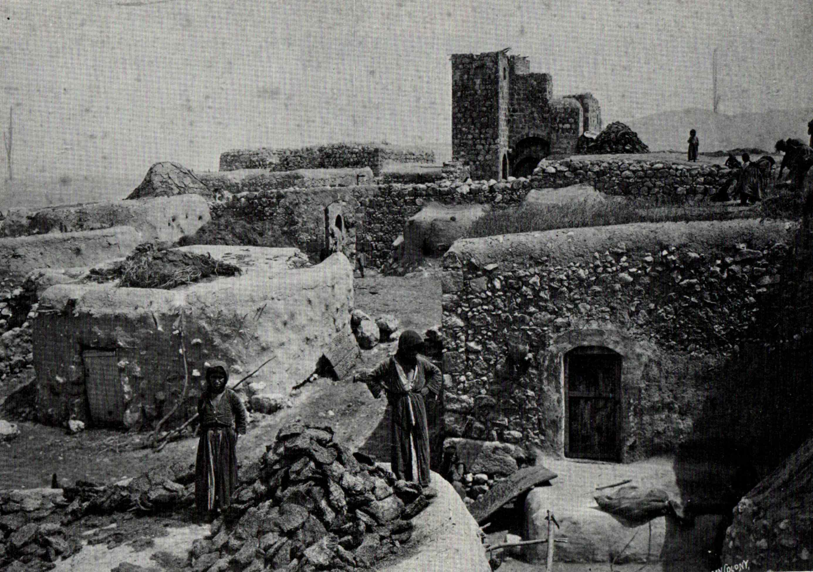
Zir'in (bahasa Arab : زرعين , juga disebut Zerein ) adalah sebuah desa Arab Palestina di Lembah Jezreel , yang berjarak 11 kilometer (6,8 mi) dari utara Jenin . Diidentifikasikan sebagai kota kuno Yizre'el (Jezreel) , desa terebut dikenal sebagai Zir'in pada masa kekuasaan Islam, dan berada di dekat situs Pertempuran Ain Jalut , dimana Mamluk menghadapi ekspansi Mongol dari wilayah selatan. Di bawah kekuasaan Utsmaniyah, desa tersebut menjadi sebuah desa kecil, diperlebar pada masa Mandat Britania pada awal abad ke-20. Setelah direbut oleh Israel pada 1948, Zir'in dihancurkan.
Referensi
^ Morris, 2004, p. xvii , village #121. Also gives cause of depopulation
Daftar pustaka
Barron, J.B., ed. (1923). Palestine: Report and General Abstracts of the Census of 1922 Conder, C.R. ; Kitchener, H.H. (1882). The Survey of Western Palestine: Memoirs of the Topography, Orography, Hydrography, and Archaeology Committee of the Palestine Exploration Fund .Government of Palestine, Department of Statistics (1945). Village Statistics, April, 1945 Guérin, V. (1874). Description Géographique Historique et Archéologique de la Palestine Pemeliharaan CS1: Bahasa yang tidak diketahui (link ) (pp.311 - 323 )Hadawi, S. (1970). Village Statistics of 1945: A Classification of Land and Area ownership in Palestine Hütteroth, Wolf-Dieter; Abdulfattah, Kamal (1977). Historical Geography of Palestine, Transjordan and Southern Syria in the Late 16th Century ISBN 3-920405-41-2 Karmon, Y. (1960). "An Analysis of Jacotin's Map of Palestine" (PDF) . Israel Exploration Journal 10 (3, 4): 155– 173, 244– 253. Diarsipkan dari asli (PDF) tanggal 2019-12-22. Diakses tanggal 2020-07-23 . Khalidi, W. (1992). All That Remains: The Palestinian Villages Occupied and Depopulated by Israel in 1948 Washington D.C. : Institute for Palestine Studies . ISBN 0-88728-224-5 Lyons, Malcolm Cameron; Jackson, D.E.P. (1984). Saladin: the Politics of the Holy War Cambridge University Press . ISBN 978-0-521-31739-9 Mills, E., ed. (1932). Census of Palestine 1931. Population of Villages, Towns and Administrative Areas Morris, B. (2004). The Birth of the Palestinian Refugee Problem Revisited ISBN 978-0-521-00967-6 Palmer, E.H. (1881). The Survey of Western Palestine: Arabic and English Name Lists Collected During the Survey by Lieutenants Conder and Kitchener, R. E. Transliterated and Explained by E.H. Palmer Committee of the Palestine Exploration Fund .p.172 )Petersen, Andrew (2001). A Gazetteer of Buildings in Muslim Palestine (British Academy Monographs in Archaeology) Oxford University Press . ISBN 978-0-19-727011-0 Pringle, Denys (1993). The Churches of the Crusader Kingdom of Jerusalem: A-K (excluding Acre and Jerusalem) Cambridge University Press . ISBN 0 521 39036 2 276 -278)Pringle, Denys (1997). Secular buildings in the Crusader Kingdom of Jerusalem: an archaeological Gazetter Cambridge University Press . ISBN 0521 46010 7 Pringle, Denys (2009). The Churches of the Crusader Kingdom of Jerusalem: The cities of Acre and Tyre with Addenda and Corrigenda to Volumes I-III Cambridge University Press . ISBN 978-0-521-85148-0 269 -272)Robinson, E. ; Smith, E. (1841). Biblical Researches in Palestine, Mount Sinai and Arabia Petraea: A Journal of Travels in the year 1838 Crocker & Brewster .Tal, D. (2004). War in Palestine, 1948: Strategy and Diplomacy ISBN 0-7146-5275-X Wilson, C.W., ed. (c. 1881). Picturesque Palestine, Sinai and Egypt D. Appleton .
Pranala luar


