"Nilin" beralih ke halaman ini. Untuk karakter permainan video dengan nama ini, lihat
Nilin (Remember Me) .
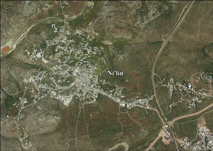
Ni'lin (bahasa Arab : نعلين ) adalah sebuah kota Palestina di Kegubernuran Ramallah dan al-Bireh di tengah Tepi Barat , berjarak 17 kilometer (11 mi) dari barat Ramallah . Ni'lin berjarak sekitar 3 kilometer (1,9 mi) dari timur Garis Gencatan Senjata tahun 1949 (Garis Hijau) yang berbatasan dengan Deir Qaddis , pemukiman Israel Nili dan Na'ale di timur laut, desa al-Midya dand blok pemukiman Modi'in Illit (Kiryat Sefer) di selatan, desa Budrus (4 km) dan Qibya (5 km) yang terletak di barat laut.
Catatan kaki
Daftar pustaka
Barron, J.B., ed. (1923). Palestine: Report and General Abstracts of the Census of 1922 Conder, C.R. ; Kitchener, H.H. (1882). The Survey of Western Palestine: Memoirs of the Topography, Orography, Hydrography, and Archaeology Committee of the Palestine Exploration Fund .Finkelstein, I. ; Lederman, Zvi, ed. (1997). Highlands of many cultures Tel Aviv : Institute of Archaeology of Tel Aviv University Publications Section. ISBN 965-440-007-3 Government of Jordan, Department of Statistics (1964). First Census of Population and Housing. Volume I: Final Tables; General Characteristics of the Population (PDF) . Government of Palestine, Department of Statistics (1945). Village Statistics, April, 1945 Hadawi, S. (1970). Village Statistics of 1945: A Classification of Land and Area ownership in Palestine Hartmann, M. (1883). "Die Ortschaftenliste des Liwa Jerusalem in dem türkischen Staatskalender für Syrien auf das Jahr 1288 der Flucht (1871)" . Zeitschrift des Deutschen Palästina-Vereins . 6 : 102– 149.Hütteroth, Wolf-Dieter; Abdulfattah, Kamal (1977). Historical Geography of Palestine, Transjordan and Southern Syria in the Late 16th Century ISBN 3-920405-41-2 Mills, E., ed. (1932). Census of Palestine 1931. Population of Villages, Towns and Administrative Areas Palmer, E.H. (1881). The Survey of Western Palestine: Arabic and English Name Lists Collected During the Survey by Lieutenants Conder and Kitchener, R. E. Transliterated and Explained by E.H. Palmer Committee of the Palestine Exploration Fund .Robinson, E. ; Smith, E. (1841). Biblical Researches in Palestine, Mount Sinai and Arabia Petraea: A Journal of Travels in the year 1838 Crocker & Brewster .Röhricht, R. (1887). "Studien zur mittelalterlichen Geographie und Topographie Syriens" . Zeitschrift des Deutschen Palästina-Vereins . 10 : 195– 344.Röhricht, R. (1893). (RRH) Regesta regni Hierosolymitani (MXCVII-MCCXCI) Socin, A. (1879). "Alphabetisches Verzeichniss von Ortschaften des Paschalik Jerusalem" . Zeitschrift des Deutschen Palästina-Vereins . 2 : 135– 163.
Pranala luar


