Santo Niño |
|---|
|
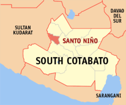 Peta Cotabato Selatan dengan Santo Niño dipaparkan |
 |
|
| Koordinat: 6°26′N 124°41′E / 6.43°N 124.68°E / 6.43; 124.68Koordinat: 6°26′N 124°41′E / 6.43°N 124.68°E / 6.43; 124.68 |
| Negara | Filipina |
|---|
| Daerah | Soccsksargen (Daerah XII) |
|---|
| Wilayah | Cotabato Selatan |
|---|
| Barangay | 10 |
|---|
| Tarikh asas | 7 April 1981 |
|---|
|
| • Pengundi | 25,071 (9 Mei 2022) |
|---|
|
| • Jumlah | 86.20 km2 (33.28 batu persegi) |
|---|
| Aras | 160 m (520 ft) |
|---|
|
| • Jumlah | 39,796 |
|---|
| • Kepadatan | 460/km2 (1,200/batu persegi) |
|---|
| • Bilangan rumah | 9,892 |
|---|
|
| • Kelas pendapatan | pendapatan kelas ketiga perbandaran |
|---|
| • Kadar kemiskinan | 17.73% (2021)[3] |
|---|
| • Hasil | ₱159,945,788.17 (2020) |
|---|
| • Aset | ₱374,542,957.66 (2020) |
|---|
| • Liabiliti | ₱88,123,129.95 (2020) |
|---|
| • Perbelanjaan | ₱131,475,118.99 (2020) |
|---|
| Zon waktu | UTC+8 (UTC+08:00) |
|---|
| Poskod | 9509 |
|---|
| PSGC | 126318000 |
|---|
| Kod kawasan | +63 (0)83 |
|---|
| Jenis iklim | Iklim khatulistiwa |
|---|
| Bahasa peribumi | bahasa Hiligai
bahasa Sugbu
bahasa Magindanau
Blaan
bahasa Tagalog |
|---|
| Laman sesawang | stoninoscot.gov.ph |
|---|
Santo Niño atau lebih dikenali sebagai Perbandaran Santo Niño merupakan sebuah perbandaran di wilayah Cotabato Selatan, Filipina. Perbandaran ini mempunyai jumlah penduduk seramai 39,796 dalam isi rumah 9,892. Ia mempunyai luas 86.20 kilometer persegi dan ketinggian 160 meter di atas permukaan laut. Ia diberikan dengan kod kawasan telefon +63 (0)83 dan poskod 9509.
Barangay
- Ambalgan
- Guinsang-an
- Katipunan
- Manuel Roxas
- Panay
- Poblacion
- San Isidro
- San Vicente
- Teresita
- Sajaneba
Demografi
Kependudukan
Santo Niño| Tahun | Pend. | ±% setiap
tahun |
|---|
| 1990 | 30,076 | — |
|---|
| 1995 | 32,103 | +1.23% |
|---|
| 2000 | 36,228 | +2.63% |
|---|
| 2007 | 38,400 | +0.81% |
|---|
| 2010 | 39,738 | +1.25% |
|---|
| 2015 | 40,947 | +0.57% |
|---|
| 2020 | 39,796 | −0.56% |
|---|
| Ref:
Lembaga Perangkaan Filipina [4] [5] [6] |
Ekonomi
Rujukan
Pautan luar

.svg)