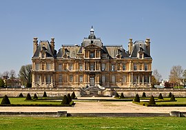
Maisons-Laffitte |
|---|
|
 |
 Coat of arms |
 Location (in red) within Paris inner and outer suburbs |
Location of Maisons-Laffitte |
Show map of Île-de-France (region) |
| Coordinates: 48°56′49″N 2°08′44″E / 48.9469°N 2.1456°E / 48.9469; 2.1456 |
| Country | France |
|---|
| Region | Île-de-France |
|---|
| Department | Yvelines |
|---|
| Arrondissement | Saint-Germain-en-Laye |
|---|
| Canton | Sartrouville |
|---|
| Intercommunality | CA Saint Germain Boucles Seine |
|---|
|
| • Mayor (2020–2026) | Jacques Myard[1] |
|---|
| Area 1 | 6.75 km2 (2.61 sq mi) |
|---|
| Population | 23,361 |
|---|
| • Density | 3,500/km2 (9,000/sq mi) |
|---|
| Time zone | UTC+01:00 (CET) |
|---|
| • Summer (DST) | UTC+02:00 (CEST) |
|---|
| INSEE/Postal code | |
|---|
| Elevation | 22–57 m (72–187 ft)
(avg. 38 m or 125 ft) |
|---|
| 1 French Land Register data, which excludes lakes, ponds, glaciers > 1 km2 (0.386 sq mi or 247 acres) and river estuaries. |