Interstate 64 |
|---|
 |
|
| Length | 953.74 mi[1][2] (1,534.90 km) |
|---|
| Existed | 1961–present |
|---|
| NHS | Entire route |
|---|
|
| West end |    I-70 / US 40 / US 61 in Wentzville, MO I-70 / US 40 / US 61 in Wentzville, MO |
|---|
| Major intersections |   I-55 / I-70 in St. Louis, MO I-55 / I-70 in St. Louis, MO
 I-57 in Mt. Vernon, IL I-57 in Mt. Vernon, IL
  I-65 / I-71 in Louisville, KY I-65 / I-71 in Louisville, KY
 I-75 in Lexington, KY I-75 in Lexington, KY
 I‑77 in Charleston, WV I‑77 in Charleston, WV
 I-81 in Lexington, VA I-81 in Lexington, VA
 I-95 in Richmond, VA I-95 in Richmond, VA |
|---|
| East end |   I-264 / I-664 in Chesapeake, VA I-264 / I-664 in Chesapeake, VA |
|---|
|
|
|---|
|
| Country | United States |
|---|
|
|
|---|
|
|
|
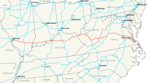
Interstate 64 is a long Interstate Highway in the United States. It goes from Wentzville, Missouri east to Chesapeake, Virginia. The route is 953.74 miles (1,534.90 km) long.[1][2]
References
|
|---|
| Signed | |
|---|
| Unsigned | |
|---|
| Lists | |
|---|
Major Interstates highlighted |
KML is from Wikidata