Hochvogel
| Hochvogel | |
|---|---|
 Hochvogel | |
| Highest point | |
| Elevation | 2592m |
| Prominence | 572 m ↓ Hornbachjoch → Großer Krottenkopf |
| Isolation | 5.4 km → Urbeleskarspitze to Urbeleskarspitze  |
| Coordinates | 47°22′52″N 10°26′14″E / 47.38111°N 10.43722°E |
| Geography | |
| Parent range | Hochvogel- and Rosszahn Group, Allgäu Alps |
| Geology | |
| Age of rock | Triassic |
| Mountain type | Dolomite[1] Felsgipfel |
| Climbing | |
| First ascent | 1832 by Trobitius |
| Normal route | Bad Hindelang – Prinz Luitpold Haus – Hochvogel |


The Hochvogel is a 2,592 metres (8,504 ft) high mountain in the Allgäu Alps. The border between Germany and Austria runs over the summit. Climbers can ascend the summit on two marked routes. One of the most interesting climbs is by Hermann von Barth. He stayed overnight at the summit in 1869. On 14 December 1945 an American Flying Fortress crashed on the west of the Hochvogel.[2]
Gallery
-
 Northern aspect from the Jubiläumsweg (Allgäu Alps)
 -
 Southern aspect with the Kaufbeurer Haus and Hornbachtal
 -
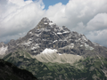 Southern side of the summit from the Kaufbeurer Haus
 -
 From Hinterhornbach


References
- ↑ Geologische Karte von Bayern mit Erläuterungen (1:500,000). Bayerisches Geologisches Landesamt, 1998.
- ↑ "Wanderpfa - History". Archived from the original on 2016-11-22. Retrieved 2017-01-21.
Sources and maps
- Anton Spiehler, Die Allgäuer Alpen, in Die Erschliessung der Ostalpen, Volume 1, 1893, pp. 47–48. (in German)
- Alpenvereinsführer Allgäuer Alpen 9th edition 1974, Bergverlag Rudolf Rother, ISBN 3-7633-1101-7, out of print;
- Alpenvereinsführer Allgäuer Alpen und Ammergauer Alpen alpin 16th edition 2004, Bergverlag Rudolf Rother, ISBN 3-7633-1126-2;
- Alpenvereinskarte 2/2 Allgäuer-Lechtaler Alpen – Ost 1:25,000 7th edition 2002;
- Gipfelziele Allgäuer Alpen 1987, Bruckmann Verlag, ISBN 3-7654-2095-6, out of print
- Kristian Rath und Tobias Burger, Prinz-Luitpold-Haus DAV-Hüttenführer – Wandern, Klettern, Abenteuer rund um den Hochvogel, Kempten 2006, ISBN 3-9810320-2-0.
- Wanderführer Hinterhornbach. Natur- und kulturkundlicher Wanderführer von Gustav und Georg Dinger, hrsg. v. d. Sektion Donauwörth d. Deutschen Alpenvereins, Verlag Ludwig Auer, ISBN 978-3-9807169-6-3
- Hermann von Barth, Einsame Bergfahrten, Albert Langen Verlag Munich, o.J. (description of the above-mentioned summit crossing)
Other websites

Wikimedia Commons has media related to Hochvogel.
Content Disclaimer
Informasi ini disarikan dari Wikipedia dan disajikan kembali untuk tujuan edukasi. Konten tersedia di bawah lisensi CC BY-SA 3.0. Kami tidak bertanggung jawab atas ketidakakuratan data yang bersumber dari kontribusi publik tersebut.
- The information displayed on this website is sourced in part or in whole from Wikipedia and has been adapted for the purpose of restating it. We strive to provide accurate and relevant information, however:
- There is no guarantee of absolute accuracy. Wikipedia is an open, collaborative project that can be edited by anyone, so information is subject to change.
- It is not intended to constitute professional advice. The content displayed is for informational and educational purposes only. For important decisions (e.g., medical, legal, or financial), please consult a professional.
- Content copyright. Wikipedia is licensed under the Creative Commons Attribution-ShareAlike License (CC BY-SA). This means that content may be reused with appropriate attribution and shared under a similar license.
- Responsible use. Any risk arising from the use of information from this website is entirely the responsibility of the user.