| Name
|
Image
|
Route
|
Length
|
Notes
|
Refs
|
| Baker Way |
![]() |
Chester to Delamere Forest |
13 miles (19 km) |
Starts at Chester railway station and finishes at Delamere railway station |
|
| Bishop Bennet Way |
 |
Beeston to Wirswall |
34 miles (55 km) |
|
|
| Bollin Valley Way |
|
Macclesfield to Partington |
25 miles (40 km) |
Follows the River Bollin |
[2]
|
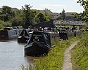
| Cheshire Ring |
 |
Dukinfield and Marple |
97-mile (156 km) |
Circular walk alongside six canals |
|
| Crewe and Nantwich Circular Walk |
 |
Crewe and Nantwich |
29 miles (47 km) |
A circular walk around the two towns |
[3]
|
| Dane Valley Way |
 |
Buxton to Northwich |
48 miles
(77 km)
|
Between Derbyshire and Cheshire partly along the River Dane |
[4]
|
| Delamere Way |
 |
Frodsham to Stockton Heath |
21 miles (33 km) |
Goes via Delamere Forest |
|
| Eddisbury Way |
 |
Frodsham to Burwardsley |
16 miles (26 km) |
Links up with the Sandstone Trail |
|
| Goyt Way |
 |
Etherow Country Park to Whaley Bridge |
10 miles (16 km) |
Links up with Midshires Way |
|
| Great English Walk |
|
Chepstow to Berwick-upon-Tweed |
583 miles (938 km) |
Passes through Cheshire between the Shropshire border at Grindley Brook and the Staffordshire border near Congleton |
[5]
|
| Gritstone Trail |
 |
Disley to Kidsgrove, Staffordshire |
35 miles (56 km) |
Passes through Teggs Nose Country Park |
|
| Ladybrook Valley Interest Trail |
|
Disley to Cheadle |
12 miles (20 km) |
Finishes at the National Trust's Lyme Park |
[6]
|
| Longster Trail |
|
Helsby Hill to Chester |
10 miles (16 km) |
|
|
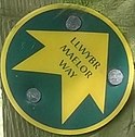
| Maelor Way |
 |
Bronygarth to Whitchurch |
24 miles (39 km) |
Finishes in Shropshire |
|
| Marches Way |
 |
Chester railway station to Cardiff |
200 miles (320 km) |
Initially following the River Dee to Farndon, then passing through the border counties |
|
| Middlewood Way |
 |
Macclesfield to Marple |
10 miles (16 km) |
|
|
| Midshires Way |
|
Bledlow, Buckinghamshire, to Stockport |
230 miles (370 km) |
|
|
| North Cheshire Way |
 |
Hooton to Disley |
71 miles (114 km) |
Linking the Wirral Way, Sandstone Trail and Gritstone Trail |
|
| Peak District Boundary Walk |

|
Buxton circular |
190 miles (310 km) |
The Cheshire section is between the Dane Valley near Wincle and past Lyme Park towards Whaley Bridge
|
| Salter's Way |
|
Rudheath (near Northwich) to Jenkin Chapel, Rainow |
25 miles (40 km) |
|
[7]
|
| Sandstone Trail |
 |
Frodsham to Whitchurch, Shropshire |
34 miles (55 km) |
|
|
| South Cheshire Way |
 |
Grindley Brook to Mow Cop |
32 miles (51 km) |
Can be used as a link between the Sandstone Trail and the Gritstone Trail |
|
| Trans Pennine Trail |
 |
Southport to Hornsea |
207 miles (333 km) |
From Yorkshire to Merseyside passing through Widnes |
|
| Two Saints Way |
|
Chester to Lichfield |
92 miles |
|
|
| Weaver Way |
|
Frodsham to Audlem |
40 miles (65 km) |
Via the River Weaver, the Trent and Mersey Canal and Shropshire Union Canal |
[8]
|
| Wirral Way |
 |
Wirral |
|
A circular trail around the Wirral Peninsula taking in part of West Cheshire and Hadlow Road railway station |
|