District in Madagascar
Belon'i Tsiribihina |
|---|
|
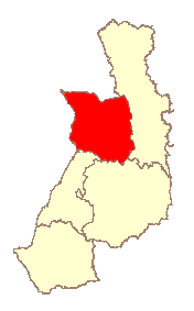
 The location of Belon'i Tsiribihina within the Menabe Region |
| Country |  Madagascar Madagascar |
|---|
|
• Total | 8,038 km2 (3,103 sq mi) |
|---|
|
• Total | 138,775 |
|---|
| • Density | 17/km2 (45/sq mi) |
|---|
| Postal code | 608 |
|---|
Belon'i Tsiribihina (also referred to as Belo sur Tsiribihina) is a district of the Menabe region of Madagascar[1][2] and borders the Miandrivazo region to the east, the Mahabo to the southeast, and the Morondava to the southwest. The district has an area of 8,038 km2 (3,103 sq mi), and the estimated population in 2020 was 138,775.[3]
Communes
The district is further divided into 14 communes:
Rivers
Lakes
The Bedo lake, Kiboy Lake and the Kimanaomby Lake.
Roads
The district is crossed by the unpaved National road 8 from south to north.
Protected areas
Site RAMSAR
References