Middlesex County, Connecticut

Middlesex County
Raymond E Baldwin Courthouse
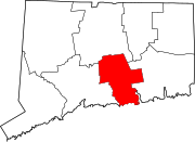
Map of Connecticut highlighting Middlesex County
Location within the U.S. state of Connecticut
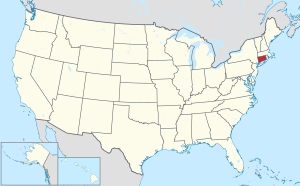
Map of the United States highlighting Connecticut
Connecticut's location within the U.S.
Coordinates: 41°26′N 72°31′W / 41.44°N 72.52°W / 41.44; -72.52
Country United States
State Connecticut
FoundedMay, 1785
Named forMiddlesex, England
Seatnone (since 1960)
Middletown (before 1960)
Largest cityMiddletown
Area
 • Total
439 sq mi (1,140 km2)
 • Land369 sq mi (960 km2)
 • Water70 sq mi (200 km2)  15.9%
Population
 (2020)
 • Total
164,245 Decrease
 • Density370/sq mi (140/km2)
Time zoneUTC−5 (Eastern)
 • Summer (DST)UTC−4 (EDT)
Congressional districts1st, 2nd, 3rd
Map
Interactive map of Middlesex County, Connecticut

Middlesex County is a county in the south central part of the U.S. state of Connecticut. As of the 2020 census, the population was 164,245.[1] The county was created in May 1785 from portions of Hartford County and New London County.

Middlesex County is included in the Hartford-East Hartford-Middletown metropolitan statistical area known as Greater Hartford.

As with all eight of Connecticut's counties, there is now no county government and no county seat. In Connecticut, towns are responsible for all local government activities, including local police, fire and rescue, snow removal, and schools. In a few cases, neighboring towns will share certain resources, e.g. water, gas, etc. On June 6, 2022, the U.S. Census Bureau formally recognized Connecticut's nine councils of governments as county equivalents instead of the state's eight counties. Connecticut's county governments were disbanded in 1960, and the councils of governments took over some of the local governmental functions. Connecticut's eight historical counties continue to exist in name only, and are no longer considered for statistical purposes.[2]

Government

Middletown was the county seat of Middlesex County from its creation in 1785 until the elimination of county government in 1960. There is no government in Middlesex County other than the Middlesex County Judicial District. All county functions other than courts and county sheriff's departments were discontinued in 1960, and again in 2000 when the county sheriff's departments were reorganized as the Connecticut Judicial Marshal, due to political corruption in the county sheriff's departments. Joseph E. Bibisi was the last person to serve as high sheriff of Middlesex County.

Geography

The county has a total area of 439 square miles (1,140 km2), of which 369 square miles (960 km2) is land and 70 square miles (180 km2) (15.9%) is water.[3] It is the smallest county in Connecticut by land area and second-smallest by total area.

The terrain trends from mostly level along the Connecticut River and Atlantic coast to gently rolling uplands away from them. The highest elevation is close to a triangulation station in Meshomasic State Forest, at 916 feet (279 m) above sea level; the lowest point is sea level.

Middlesex County is also the home of Wadsworth Falls.

Adjacent counties

National protected areas

Demographics

Historical population
CensusPop.Note
179018,828
180019,8745.6%
181020,7234.3%
182022,4058.1%
183024,84410.9%
184024,8790.1%
185027,2169.4%
186030,85913.4%
187036,09917.0%
188035,589−1.4%
189039,52411.1%
190041,7605.7%
191045,6379.3%
192047,5504.2%
193051,3888.1%
194055,9999.0%
195067,33220.2%
196088,86532.0%
1970114,81629.2%
1980129,01712.4%
1990143,19611.0%
2000155,0718.3%
2010165,6766.8%
2020164,245−0.9%
U.S. Decennial Census[4]
1790–1960[5] 1900–1990[6]
1990–2000[7] 2010–2018[8]

2000 census

As of the census[9] of 2000, there were 155,071 people, 61,341 households, and 40,607 families living in the county. The population density was 420 inhabitants per square mile (160/km2). There were 67,285 housing units at an average density of 182 per square mile (70/km2). According to the Census of 2010, the racial makeup of the county was 89.22% White, 4.64% Black or African American, 0.17% Native American, 2.56% Asian, 0.04% Pacific Islander, 1.30% from other races, and 2.06% from two or more races. 4.73% of the population were Hispanic or Latino of any race. 20.4% were of Italian, 14.3% Irish, 11.1% English, 8.9% Polish and 8.2% German ancestry. 91.1% spoke English, 2.6% Spanish, 1.9% Italian, 1.2% French and 1.0% Polish as their first language.

There were 61,341 households, out of which 30.30% had children under the age of 18 living with them, 54.40% were married couples living together, 8.80% had a female householder with no husband present, and 33.80% were non-families. 27.20% of all households were made up of individuals, and 10.00% had someone living alone who was 65 years of age or older. The average household size was 2.43 and the average family size was 2.98.

In the county, the population was spread out, with 23.20% under the age of 18, 7.30% from 18 to 24, 31.10% from 25 to 44, 24.80% from 45 to 64, and 13.60% who were 65 years of age or older. The median age was 39 years. For every 100 females, there were 95.10 males. For every 100 females age 18 and over, there were 92.10 males.

The median income for a household in the county was $59,175, and the median income for a family was $71,319. Males had a median income of $48,341 versus $35,607 for females. The per capita income for the county was $28,251. About 2.30% of families and 4.60% of the population were below the poverty line, including 4.00% of those under age 18 and 5.90% of those age 65 or over.

2010 census

As of the 2010 United States census, there were 165,676 people, 67,202 households, and 43,743 families living in the county.[10] The population density was 448.6 inhabitants per square mile (173.2/km2). There were 74,837 housing units at an average density of 202.6 per square mile (78.2/km2).[11] The racial makeup of the county was 89.2% white, 4.7% black or African American, 2.6% Asian, 0.2% American Indian, 1.3% from other races, and 2.1% from two or more races. Those of Hispanic or Latino origin made up 4.7% of the population.[10] In terms of ancestry, 24.6% were Italian, 21.2% were Irish, 14.0% were English, 13.5% were German, 11.1% were Polish, and 3.4% were American.[12]

Of the 67,202 households, 29.4% had children under the age of 18 living with them, 51.9% were married couples living together, 9.4% had a female householder with no husband present, 34.9% were non-families, and 28.2% of all households were made up of individuals. The average household size was 2.39 and the average family size was 2.95. The median age was 43.1 years.[10]

The median income for a household in the county was $74,906 and the median income for a family was $91,589. Males had a median income of $62,031 versus $50,031 for females. The per capita income for the county was $37,519. About 3.0% of families and 6.1% of the population were below the poverty line, including 6.7% of those under age 18 and 4.3% of those age 65 or over.[13]

Demographic breakdown by town

Income

Data is from the 2010 United States Census and the 2006-2010 American Community Survey 5-Year Estimates.[14][15]

Rank Town Per capita
income
Median
household
income
Median
family
income
Population Number of
households
1 Fenwick Borough $110,127 $114,375 $250,000+ 43 26
2 Essex Town $57,365 $87,480 $105,982 6,683 2,916
3 Killingworth Town $45,404 $99,500 $108,232 6,525 2,474
4 Old Saybrook Town $43,400 $79,985 $99,595 10,242 4,247
5 Cromwell Town $41,926 $82,012 $99,362 14,005 5,752
6 Chester Town $40,783 $80,185 $89,760 3,994 1,714
7 Durham Town $39,579 $105,417 $110,583 7,388 2,610
8 Portland Town $39,100 $86,661 $96,016 9,508 3,822
9 Westbrook Town $38,158 $61,069 $72,969 6,938 2,948
10 Haddam Town $37,324 $86,179 $100,343 8,346 3,218
11 East Haddam Town $37,156 $82,695 $86,023 9,126 3,593
12 Clinton Town $37,117 $74,174 $82,839 13,260 5,303
13 Middlefield Town $36,747 $80,392 $94,432 4,425 1,742
14 Deep River Town $35,564 $65,250 $81,641 4,629 1,940
15 East Hampton Town $34,555 $88,281 $95,854 12,959 5,060
16 Middletown City $31,348 $57,655 $78,006 47,648 19,863

Race

Data is from the 2007-2011 American Community Survey 5-Year Estimates, ACS Demographic and Housing Estimates, "Race alone or in combination with one or more other races."[16]

Rank Town Population White Black Asian American
Indian
Other Hispanic
1 Middletown City 47,510 79.2% 15.7% 4.9% 0.6% 3.2% 8.1%
2 Cromwell Town 13,951 93.2% 3.9% 3.3% 0.3% 0.5% 4.2%
3 Clinton Town 13,291 95.8% 0.5% 2.1% 0.2% 1.8% 3.5%
4 East Hampton Town 12,926 95.4% 1.6% 1.7% 0.3% 1.9% 3.8%
5 Old Saybrook Town 10,307 97.8% 0.7% 1.8% 0.6% 0.0% 0.4%
6 Portland Town 9,470 96.2% 2.2% 1.0% 0.2% 1.9% 4.4%
7 East Haddam Town 9,069 99.3% 1.2% 0.0% 0.2% 0.7% 0.9%
8 Haddam Town 8,267 98.5% 1.5% 0.5% 1.5% 0.2% 2.6%
9 Durham Town 7,342 94.7% 0.5% 3.1% 0.2% 3.2% 5.3%
10 Westbrook Town 6,891 95.4% 0.5% 4.0% 1.2% 0.0% 4.5%
11 Essex Town 6,697 98.8% 0.6% 1.4% 0.1% 0.1% 0.6%
12 Killingworth Town 6,499 96.7% 0.0% 7.5% 1.4% 0.7% 3.0%
13 Deep River Town 4,652 88.7% 2.0% 0.3% 0.8% 7.5% 8.6%
14 Middlefield Town 4,418 94.3% 1.7% 4.2% 0.0% 0.7% 1.5%
15 Chester Town 3,984 98.3% 0.4% 1.7% 0.7% 0.0% 2.6%
16 Fenwick Borough 51 100.0% 5.9% 0.0% 0.0% 0.0% 0.0%

Communities

Map of Middlesex County, Connecticut showing cities, boroughs, towns, and CDPs

City

Towns

Villages are named localities within towns, but have no separate corporate existence from the towns they are in.

Politics

Middlesex County is a statewide bellwhether. Since 1948, the winning statewide candidate has also carried Middlesex County, the longest active streak in the state.

United States presidential election results for Middlesex County, Connecticut[17]
Year Republican Democratic Third party(ies)
No.  % No.  % No.  %
2024 41,654 42.71% 54,173 55.55% 1,692 1.74%
2020 40,665 40.99% 56,848 57.30% 1,690 1.70%
2016 38,867 43.86% 45,357 51.18% 4,400 4.96%
2012 34,591 41.41% 47,855 57.29% 1,092 1.31%
2008 32,918 37.73% 52,984 60.72% 1,351 1.55%
2004 35,252 41.97% 47,292 56.31% 1,440 1.71%
2000 29,295 37.83% 43,319 55.94% 4,819 6.22%
1996 22,960 31.98% 37,695 52.51% 11,131 15.51%
1992 24,646 30.42% 34,707 42.83% 21,674 26.75%
1988 34,682 50.01% 33,946 48.95% 716 1.03%
1984 39,580 59.32% 26,915 40.34% 227 0.34%
1980 28,989 45.53% 24,768 38.90% 9,915 15.57%
1976 31,115 51.39% 29,097 48.05% 338 0.56%
1972 33,249 57.90% 23,573 41.05% 602 1.05%
1968 21,999 45.34% 23,727 48.90% 2,798 5.77%
1964 14,697 32.45% 30,517 67.39% 71 0.16%
1960 22,045 49.87% 22,158 50.13% 1 0.00%
1956 25,496 64.80% 13,851 35.20% 0 0.00%
1952 22,157 58.38% 15,722 41.43% 73 0.19%
1948 16,119 51.56% 14,609 46.73% 537 1.72%
1944 14,315 51.05% 13,551 48.32% 176 0.63%
1940 13,447 50.69% 13,044 49.17% 39 0.15%
1936 10,925 46.34% 12,294 52.14% 359 1.52%
1932 10,770 52.79% 9,286 45.52% 344 1.69%
1928 11,205 59.92% 7,380 39.47% 115 0.61%
1924 9,383 65.22% 4,009 27.87% 994 6.91%
1920 8,447 65.24% 4,170 32.21% 331 2.56%
1916 4,524 53.42% 3,765 44.46% 179 2.11%
1912 2,892 35.43% 3,393 41.57% 1,878 23.01%
1908 5,071 61.92% 2,935 35.84% 183 2.23%
1904 4,991 60.00% 3,167 38.07% 160 1.92%
1900 5,000 60.81% 3,102 37.72% 121 1.47%
1896 22,396 62.21% 12,463 34.62% 1,139 3.16%
1892 15,777 45.92% 18,006 52.41% 572 1.66%
1888 14,934 48.41% 15,251 49.44% 663 2.15%
1884 12,293 47.41% 12,966 50.01% 669 2.58%

See also

References

  1. ^ "Census - Geography Profile: Middlesex County, Connecticut". United States Census Bureau. Retrieved November 20, 2021.
  2. ^ https://www.federalregister.gov/documents/2022/06/06/2022-12063/change-to-county-equivalents-in-the-state-of-connecticut Federal Register: Change to County-Equivalents in the State of Connecticut
  3. ^ "US Gazetteer files: 2010, 2000, and 1990". United States Census Bureau. February 12, 2011. Retrieved April 23, 2011.
  4. ^ "U.S. Decennial Census". United States Census Bureau. Retrieved June 11, 2014.
  5. ^ "Historical Census Browser". University of Virginia Library. Retrieved June 11, 2014.
  6. ^ "Population of Counties by Decennial Census: 1900 to 1990". United States Census Bureau. Retrieved June 11, 2014.
  7. ^ "Census 2000 PHC-T-4. Ranking Tables for Counties: 1990 and 2000" (PDF). United States Census Bureau. Archived (PDF) from the original on October 9, 2022. Retrieved June 11, 2014.
  8. ^ "State & County QuickFacts". United States Census Bureau. Archived from the original on June 7, 2011. Retrieved June 11, 2014.
  9. ^ "U.S. Census website". United States Census Bureau. Retrieved May 14, 2011.
  10. ^ a b c "DP-1 Profile of General Population and Housing Characteristics: 2010 Demographic Profile Data". United States Census Bureau. Archived from the original on February 13, 2020. Retrieved January 12, 2016.
  11. ^ "Population, Housing Units, Area, and Density: 2010 - County". United States Census Bureau. Archived from the original on February 13, 2020. Retrieved January 12, 2016.
  12. ^ "DP02 SELECTED SOCIAL CHARACTERISTICS IN THE UNITED STATES – 2006-2010 American Community Survey 5-Year Estimates". United States Census Bureau. Archived from the original on February 13, 2020. Retrieved January 12, 2016.
  13. ^ "DP03 SELECTED ECONOMIC CHARACTERISTICS – 2006-2010 American Community Survey 5-Year Estimates". United States Census Bureau. Archived from the original on February 13, 2020. Retrieved January 12, 2016.
  14. ^ "SELECTED ECONOMIC CHARACTERISTICS 2006-2010 American Community Survey 5-Year Estimates". U.S. Census Bureau. Archived from the original on February 12, 2020. Retrieved November 25, 2012.
  15. ^ "Profile of General Population and Housing Characteristics: 2010 Demographic Profile Data". U.S. Census Bureau. Archived from the original on May 21, 2019. Retrieved November 25, 2012.
  16. ^ "ACS DEMOGRAPHIC AND HOUSING ESTIMATES 2007-2011 American Community Survey 5-Year Estimates". U.S. Census Bureau. Archived from the original on February 12, 2020. Retrieved January 8, 2013.
  17. ^ Leip, David. "Dave Leip's Atlas of U.S. Presidential Elections". uselectionatlas.org. Retrieved May 26, 2017.

41°26′N 72°31′W / 41.44°N 72.52°W / 41.44; -72.52

Read other articles:

CombonganKelurahanKantor Lurah CombonganNegara IndonesiaProvinsiJawa TengahKabupatenSukoharjoKecamatanSukoharjoKodepos57519Kode Kemendagri33.11.04.1008 Kode BPS3311040008 Luas-1560kmJumlah penduduk-754Kepadatan- Combongan adalah kelurahan di kecamatan Sukoharjo, Sukoharjo, Jawa Tengah, Indonesia. Pembagian wilayah Kelurahan Combongan terdiri dari beberapa kampung, antara lain: Badan Cinderejo Combongan Gandu Kamongan Kebakan Kutut Muningan Pasekan Pondokrejo Samban Sidomakmur Sidorejo Te...


Hadinijah Hadi Ngabdulhadi adalah seorang politikus Indonesia kelahiran Purwokerto pada 5 Januari 1928. Ia menempuh pendidikan di Muallimat dalam Sekolah Guru Puteri Islam. Ia kemudian pindah ke Barabai, Kalimantan Selatan. Di Barabai, ia aktif mengajar di Sekolah Rakyat Islam Haruyan dari 1945 sampai 1947. Ia kemudian pindah mengajar di Muallimat Barabai sampai 1949. Ia sempat menjabat sebagai Ketua Cabang Perwani (Persatuan Wanita Indonesia) Barabai. Ia juga sempat menjadi Wakil Ketua Caban...


Divisi Dua Puluh Delapan Pengawal Panfilov (Rusia: Двадцать восемь гвардейцев дивизии Панфиловаcode: ru is deprecated ), umum disebut sebagai Pasukan Panfilov (Rusia: Панфиловцыcode: ru is deprecated , Panfilovtsy), adalah sekelompok prajurit dari Divisi Senapan ke-316 Tentara Merah yang ikut serta dalam Pertempuran Moskwa pada Perang Dunia II. Menurut sejarah Soviet resmi, mereka semua tewas dalam aksi pada 16 November 1941, setelah menghanc...

Bintang Kranggan FCNama lengkapBintang Kranggan Football ClubBerdiri1986; 38 tahun lalu (1986)StadionLapangan Hankam KalimanggisJakarta Timur, DKI JakartaPemilikPT. Bintang KrangganKetuaFerry SyahputraLigaLiga 3 Bintang Kranggan FC (atau disingkat BKFC) adalah tim sepak bola Indonesia yang bermarkas di Lapangan Hankam Kalimanggis, Kota Jakarta Timur, DKI Jakarta. Tim ini berkompetisi di Liga 3 Zona DKI Jakarta.[1] Referensi ^ https://www.pssi.org/news/bintang-kranggan-siap-hadapi...


2000 Vermont Democratic presidential primary ← 1996 March 7, 2000 (2000-03-07) 2004 → ← RIWA →22 delegates to the Democratic National Convention (15 pledged, 7 unpledged)The number of pledged delegates received is determined by the popular vote   Candidate Al Gore Bill Bradley Home state Tennessee New Jersey Delegate count 9 6 Popular vote 26,774 21,629 Percentage 54.33% 43.89% County results Municipality resultsG...


1939 film For the fantasy novel by Jim Butcher, see Captain's Fury. Captain FuryFilm posterDirected byHal RoachWritten byGrover JonesJack JevneWilliam C. deMilleProduced byHal RoachStarringBrian AherneVictor McLaglenCinematographyNorbert BrodineEdited byWilliam H. ZieglerMusic byMarvin HatleyProductioncompanyHal Roach StudiosDistributed byUnited ArtistsRelease date May 26, 1939 (1939-05-26) Running time92 minutesCountryUnited StatesLanguageEnglishBudget£250,000[1]Box o...

This article is about the 2019 TV series. For the 2022 TV series, see See You Again (2022 TV series). Chinese TV series or program See You AgainAlso known asTime Knows EverythingGenreRomanceSci-FiBased onTime Knows Everything by Sui HouzhuWritten byGao XuanRen BaoruZhou ZhanCheng Xuefei[1]Directed byZhong ShujiaStarringTiffany TangShawn DouYang ShuoOpening themeTime Knows Everything by Chen LiEnding themeI Say by Yida HuangCountry of originChinaOriginal languageMandarinNo. of seasons1...


Part of a series onAnarchism History Outline Schools of thought Feminist Green Primitivist Social ecology Total liberation Individualist Egoist Free-market Naturist Philosophical Mutualism Postcolonial African Black Queer Religious Christian Jewish Social Collectivist Parecon Communist Magonism Without adjectives Methodology Agorism Illegalism Insurrectionary Communization Expropriative Pacifist Platformism Especifismo Relationship Syndicalist Synthesis Theory Practice Anarchy Anarchist Blac...


Process during package sorting and delivery Tracking packages with stationary bar code reader in a warehouse sorting operation Package tracking or package logging is the process of localizing shipping containers, mail and parcel post at different points of time during sorting, warehousing, and package delivery to verify their provenance and to predict and aid delivery. Package tracking developed historically because it provided customers information about the route of a package and the antici...

Radio station in Walsenburg–Pueblo, Colorado For the economic planning office in South Korea, see Korea Free Economic Zone. KFEZWalsenburg, ColoradoBroadcast areaPueblo, ColoradoWalsenburg, ColoradoRocky Ford, ColoradoColorado Springs, ColoradoFrequency101.3 MHzBrandingGnarly 101.3ProgrammingFormat80's hitsOwnershipOwnerEdward MagnusHistoryFirst air date2009 (as KOCK)Former call signsKWCS (2005–2008)KOCK (2008–2012)Call sign meaningK F EZ (Easy) (previous format)Technical informationFac...


Cet article est une ébauche concernant un aéroport chinois. Vous pouvez partager vos connaissances en l’améliorant (comment ?) selon les recommandations des projets correspondants. Pour les articles homonymes, voir GMQ. Aéroport de Golog-Maqin果洛玛沁机场guǒluò măqìn jīchǎng Localisation Pays Chine Ville Golog Coordonnées 34° 25′ 17″ nord, 100° 18′ 06″ est Altitude 3 787 m (12 425 ft) Informations aéronautiques Code I...


第三十二届夏季奥林匹克运动会男子60公斤級古典式摔跤比賽比賽場館千葉市幕張展覽館日期2021年8月1日至2日参赛选手16位選手,來自16個國家和地區奖牌获得者01 ! 路易斯·奥尔塔  古巴02 ! 文田健一郎  日本03 ! 瓦里汗·赛里克  中国03 ! 谢尔盖·叶梅林  俄罗斯奥林匹克委员会← 20162024 → 2020年夏季奥林匹克运动会摔跤比赛男子自由式�...

2020年夏季奥林匹克运动会马来西亚代表團马来西亚国旗IOC編碼MASNOC马来西亚奥林匹克理事会網站olympic.org.my(英文)2020年夏季奥林匹克运动会(東京)2021年7月23日至8月8日(受2019冠状病毒病疫情影响推迟,但仍保留原定名称)運動員30參賽項目10个大项旗手开幕式:李梓嘉和吳柳螢(羽毛球)[1][2]閉幕式:潘德莉拉(跳水)[3]獎牌榜排名第74 金牌 銀牌 銅�...


中央国家安全委员会 组成人员 主席 习近平 副主席(3) 李 强、赵乐际、蔡 奇 机构概况 上级机构 中国共产党中央委员会中国共产党中央政治局 机构类型 中共中央决策和议事协调机构 办事机构 中央国家安全委员会办公室 联络方式 中央国家安全委员会办公室  实际地址 北京市 对应机构 国家安全机关:中华人民共和国国家安全部公安机关情报机构:公安部政治安全保...


Водовзводная башня Вид на Водовзводную башню с Большого Каменного моста, 2014 Местоположение Москва Кремль Московский Кремль Год постройки 1488 Форма основания башни Цилиндрическая Высота башни Со звездой — 61,25 м Без звезды — 57,7 м Толщина стен башни 3 м Другие ...

بعلشميه   الإحداثيات 33°48′56″N 35°38′41″E / 33.8155°N 35.6446°E / 33.8155; 35.6446   تقسيم إداري  البلد لبنان[1]  التقسيم الأعلى قضاء عاليهقضاء بعبدا  رمز جيونيمز 277054  تعديل مصدري - تعديل   بعلشميه هي قرية لبنانية من قرى قضاء بعبدا في محافظة جبل لبنان. يبلغ عدد �...


南极条约英語:The Antarctic Treaty法語:Traité sur l'Antarctique俄語:Договор об Антарктике西班牙語:Tratado Antártico南极条约秘书处旗帜類型共管簽署日1959年12月1日簽署地點 美国华盛顿生效日1961年6月23日生效條件12个签署国批准簽署者12締約方56保存處美國聯邦政府的档案库語言英语、法语、俄语和西班牙语收錄於维基文库的條約原文《南极条约》 維基百科中的法律...


Stemma dell'arciconfraternita La reale arciconfraternita di Maria Santissima del Rosario è una confraternita di Taranto, fondata negli anni successivi alla battaglia di Lepanto del 1571. Indice 1 Storia 2 Attività 3 Abito di rito 4 Galleria d'immagini 5 Note 6 Bibliografia Storia Chiesa di San Domenico Maggiore L'arciconfraternita fu fondata negli anni successivi al 1571 e prima del 1578, quando la sua esistenza è attestata negli Atti della visita pastorale di monsignor Brancaccio del 1578...

American temperance leader (1820–1913) Maria Hyde HibbardPortrait from Two decades, 1894BornMaria HydeSeptember 10, 1820Oxford, New York, U.S.DiedApril 30, 1913 (aged 92)Clifton Springs, New York, U.S.OccupationseducatorexecutiveKnown for President, New York State, Woman's Christian Temperance Union President, New York Branch, Woman's Foreign Missionary Society of the Methodist Episcopal Church Spouse Freeborn Garretson Hibbard ​ ​(m. 1846; died 18...


Roy Jenkins Roy Jenkins en 1977Canciller de la Universidad de Oxford 14 de marzo de 1987-5 de enero de 2003Predecesor Harold MacmillanSucesor Chris Patten Información personalNombre de nacimiento Roy Harris Jenkins Nacimiento 11 de noviembre de 1920 Abersychan (Reino Unido) Fallecimiento 5 de enero de 2003 (82 años)East Hendred (Reino Unido) Causa de muerte Infarto agudo de miocardio Nacionalidad BritánicaFamiliaPadres Arthur Jenkins Hattie Harris Cónyuge Mary Jennifer Morris (desde ...